Opened 9 years ago
Closed 9 years ago
#489 closed defect (fixed)
Add contour map capabilities to GMT web service
| Reported by: | Kevin Milner | Owned by: | |
|---|---|---|---|
| Priority: | major | Milestone: | OpenSHA 1.4 |
| Component: | commons | Version: | |
| Keywords: | Cc: |
Description
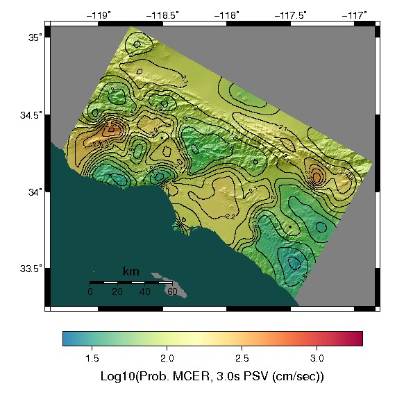
The utilization of ground motion simulations committee would like to see contoured CyberShake? maps produced. This is a fairly straightforward addition to the GMT map generator servlet, via a call to grdcontour. Contours could be either drawn on top of a traditional map, or instead of a map.
Attachments (2)
Change History (3)
Changed 9 years ago by
| Attachment: | prob_mcer_psv_contours.jpg added |
|---|
Changed 9 years ago by
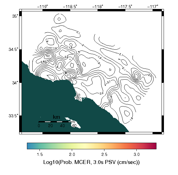
| Attachment: | prob_mcer_psv_contours_only.png added |
|---|
Example with contours only
comment:1 Changed 9 years ago by
| Resolution: | → fixed |
|---|---|
| Status: | new → closed |
Done in [10940] and [10941]. Contour maps can be enabled by setting GMT_Map.setContourIncrement(double) to a value > 0. Variable pen attributes could be added, currently just supports black 1 point. Not currently exposed via the GUI interface. Default behavior will draw contours on top of an existing map, otherwise you can call GMT_Map.setContourOnly(true) to draw the contours only. Examples below.
Example with contours drawn over a gridded image:

Example with contours only:

Example with contours over gridded image