Opened 10 years ago
Closed 10 years ago
#463 closed defect (fixed)
Get better high resolution CA topography files
| Reported by: | Kevin Milner | Owned by: | Kevin Milner |
|---|---|---|---|
| Priority: | major | Milestone: | OpenSHA 1.4 |
| Component: | commons | Version: | |
| Keywords: | Cc: |
Description
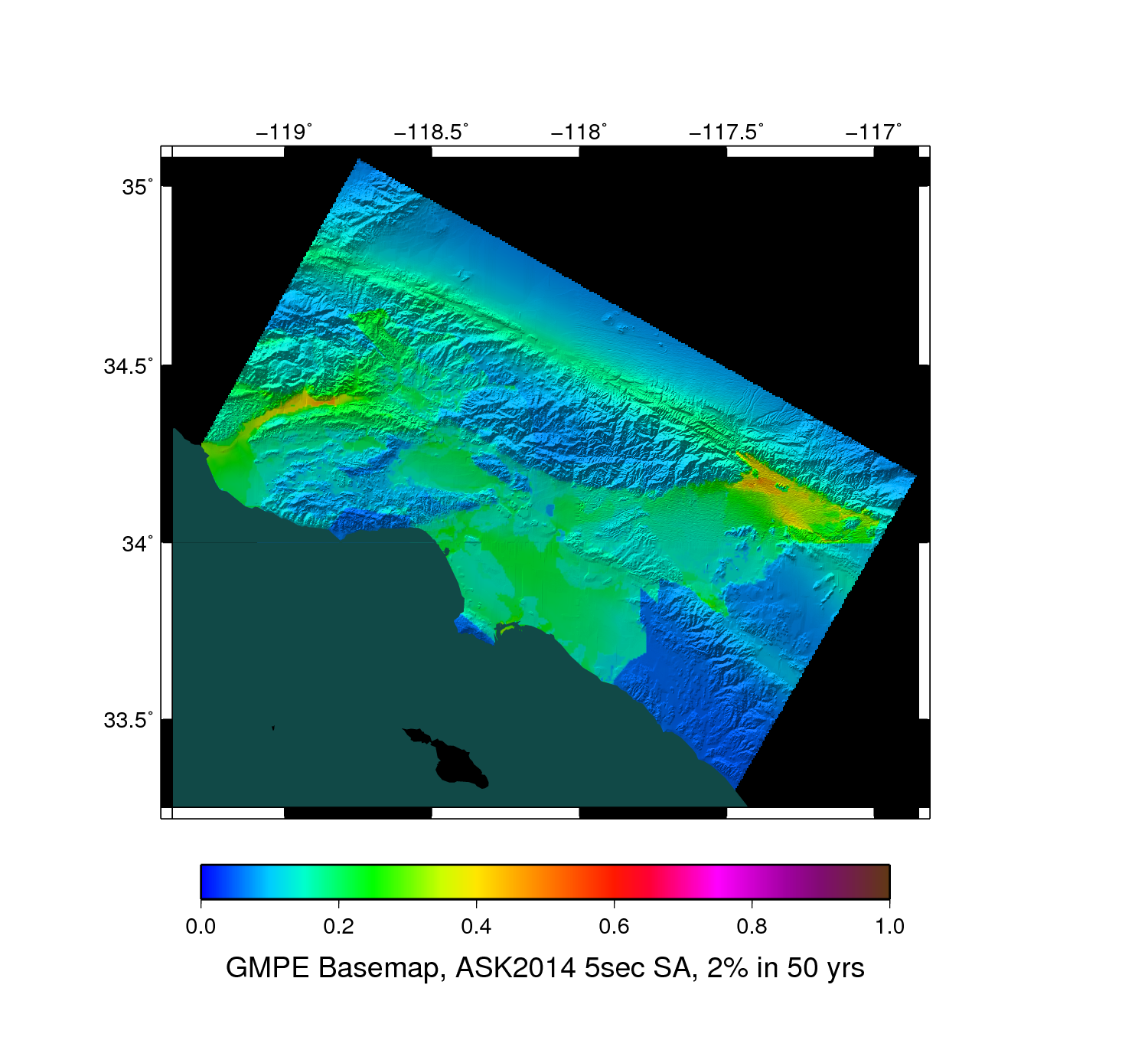
The current high resolution CA topography files were sticked together and have some strange artifacts as can be seen, for example, here:
http://scec.usc.edu/scecwiki/images/7/7d/Ask2013_5sec_2p_in_50.png
Attachments (1)
Change History (2)
Changed 10 years ago by
comment:1 Changed 10 years ago by
| Resolution: | → fixed |
|---|---|
| Status: | new → closed |
Done. Old topography files have been replace by data from US NED. The NED data is supplied in 1x1 degree, 1 arc second grids. I wrote a python script to batch download the tiles (stored in /home/scec-01/opensha/ned_usa/1sec_tiles/) and a utility class that will stitch the files together at any resolution and for any region: org.opensha.commons.mapping.gmt.topo.NED_Convert
I created 4 topo intensity files and have updated the GMT Map Generator to use them:
3 sec California
6 sec US
18 sec US
30 sec US
Note that the 30 sec US is actually much sharper than the 30 sec global data, as the global data was modified to use gridline rather than pixel resolution. There isn't a 3 sec US file because GMT can't deal with files that large.
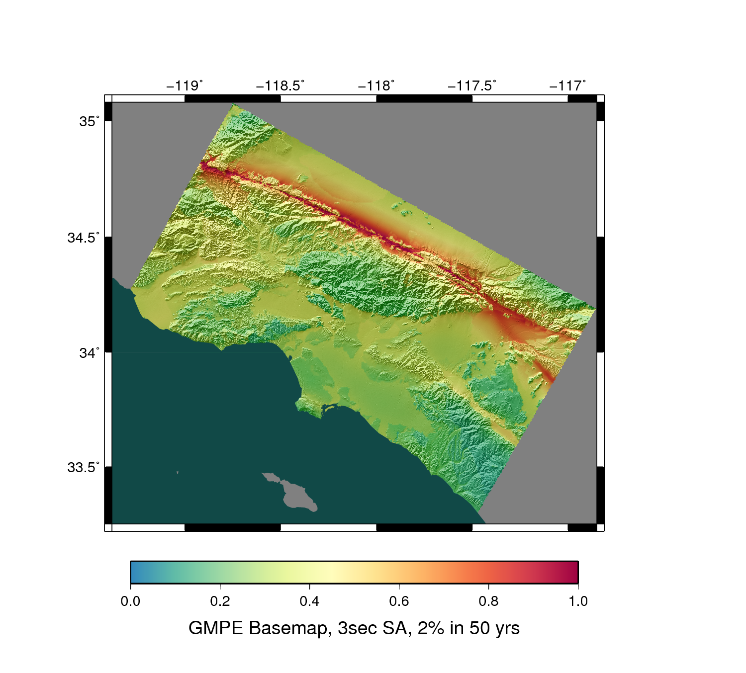
Here is a Southern CA example (note the lack of artifacts that were visible in prior maps):
http://scec.usc.edu/scecwiki/images/4/4a/New_opensha_topography.png
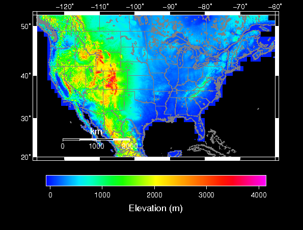
And here is a map of the US topography:
http://opensha.usc.edu/trac/attachment/ticket/463/map.png
A Site Data provider has been added for accessing high resolution topographic information if it's ever needed: org.opensha.commons.data.siteData.impl.US_3secTopography
US topography